The Mayor of London and Transport for London (TfL) launched the Capital’s first interactive digital collision map, which is part of a continued drive to improve road safety awareness to reduce the number of casualties in the London.
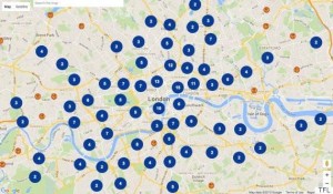
The London Collision Map http://www.collisionmap.london uses extensive data, collected by the Police and held by TfL, to shine a light on road collisions in local areas. This creates a useful new way to inform road users about junctions with high collision histories and aiding improvement work in line with TfL’s commitment to improve transparency for customers and stakeholders.
The map allows anyone to easily search for collisions anywhere within London, providing information about when, where and how severe incidents were, which date back to 2005. The aim is to help raise awareness of road conditions and encourage road users to take extra care at junctions.
The report also outlines the Mayor’s new target, set earlier this year, to halve the number of KSIs by 2020 compared to the Government base line – meaning a reduction of more than 14,000 deaths or serious injuries over the life of London’s road safety plan to 2020.
For more info about the other work TfL is carrying out please visit www.tfl.gov.uk/roadsafety